Location and how to get there
Location and how to get there


Plaza del Ayuntamiento is in a very central position, in the Sant Francesc area of the old quarters of the city. Because of its location and importance as a focal point of the city, it is rather easy to reach the square.
Location
The Town Hall Square is located in Valencia’s city centre, the Old Town. The square is the point around which the Sant Francesc neighbourhood revolves. It is only a few steps north of the Estación del Norte, just south of the Central Market and the Lonja de la Seda.
Its shape can be roughly defined as a triangle, with the two streets leading up to its base being Avenida del Marqués de Sotelo (from the train station) and Passeig de Russafa.
How to get there
Because of where Plaza del Ayuntamiento is located, chances are you will pass by it or have already done so, whether you are walking or taking a bike.
If you are in a different part of the city, you might want to take public transport.

By metro/tram
The Town Hall Square is in a great position to be reached by metro or tram, as there are various stops nearby. Depending on where you are located, one or the other might be more convenient.
The closest stations are:
- Xàtiva (view map), the metro stop in front of the main train station,
- Colón (view map), the metro stop in the commercial area.
- Alacant (view map), the tram stop between the train station and the bullring.
The metro stations are respectively 200 m south (3-minute walk, a little over 0.1 mile) and 500 m away (6-minute walk, 0.3 miles) from the square. The same three lines (3, 5, 9) stop at both stations.
The tram network’s line 10 stop called Alacant is about 400 m (5-minute walk, a little over 0.2 miles) south of the Plaza.
For detailed information about how this system works, you can read our article about the metro and trams in Valencia.

By bus
The Town Hall Square is a key point in the urban bus network, so there are quite a few buses stopping right by it.
For detailed information about tickets and how to get them, you can read our article about buses in Valencia.

| Line |
|---|
| Stop |
| Details |
| Line | C1 | 6 | 8 | 11 | 35 | 70 |
|---|---|---|---|---|---|---|
| Stop | Plaça de l’Ajuntament - Flors | Plaça de l’Ajuntament | Plaça de l’Ajuntamentl | Plaça de l’Ajuntament | Plaça de l’Ajuntament | Plaça de l’Ajuntament |
| Details | It is a circular line that runs the length of the old city walls, hugging the old quarters of the city. Some of its stops are Puerta de la Mar, Plaza del Ayuntamiento, Xátiva, Torres dels Serrans. | This line crosses the city north to south, making quite a few stops in the western part of the city and along the TuriaPark. | This is a line that dwells mostly in the southern and western parts of the city centre, around the two train stations and the Ruzafa neighbourhood. | This line crosses Valencia’s urban area from southwest to northeast. On its route, it stops by some important spots, like the Plaza del Ayuntamiento, Estación del Norte, Colón, and the TuriaPark. | It connects themain train station, the Plaza del Ayuntamiento, and theEixample with the neighbourhoods that stand between the city and its beaches. | This line connects the western areas of the city with the southern areas of the Old Town, and then proceeds towards the northeast of the city. |
By taxi
Cabs are obviously the most expensive option to move around the city, and they might not always be the most comfortable way to get to your destination.
As Plaza del Ayuntamiento is so central, we would only recommend this means of transport if your departure point is quite far from the old quarters, maybe in the outskirts of the city. It is normally quite easy to hail a taxi in the street in Valencia, but other options are also booking through a mobile app or through a phone call.
See detailed information on this in our article about taxis in Valencia.

By bike
Valencia is a very bike-friendly city, so we always recommend exploring it this way.
On the official map , you’ll see that there are bike paths circling the city’s old quarters.
You can also cycle in the city centre and its pedestrian zones, as long as there is enough room for people to walk.
On the same map, you will also see that there are two Valenbisi stations in the Plaza itself (one on the southern side, one on the western side of the square), and many others not too far away. If your tyres are flat, there’s even an air pump in the square for public use.
If you want to know more about cycling in the city, read our article about biking in Valencia or our article about Valenbisi, Valencia’s public bike rental service (with video guides).

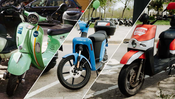
By scooter
Electric scooters are an ever-more popular transport solution in Valencia. They are ideal if you want to move independently around the city and you don’t want to get stuck in traffic, but you don’t like cycling or walking. Many scooter-sharing companies offer rental plans that let you pay per minute of use and nothing else.
You can park and drive your scooter within a designated area in the city’s urban zone. Generally, you are not allowed to park in Plaza del Ayuntamiento itself, but you can always park your scooter nearby. It will be sufficient to leave your scooter just outside the no-park zone that you will see on your app’s map.
If you want to know more about this, you can check out our article about electric scooter rentals in Valencia. In the article, you’ll find step-by-step instructions and video guides to help you through the rental process.

On foot
Given that Plaza del Ayuntamiento is so central, it is normal that reaching it on foot is not difficult at all, so if you are in the Old Town, going on foot is the easiest option. In fact, if you will find yourself passing by the square many times during your stay.
From Estación del Norte, located at the southern end of the city centre, the Town Hall Square is only 200 m away (3-minute walk, a little over 0.1 mile). To reach it you will simply have to walk north, following Avenida del Marqués de Sotelo.
From the Serranos towers, at the northern edge of the centre, you will only have to walk 1 km (12-minute walk, about 0.6 miles). This time, you will find the square south of your position.
If you’d like to explore Valencia on foot, we have created a selection of self-guided walking tours that you can enjoy at your own pace. You can find the one that best fits your needs in the Northleg itineraries section.