Transport connections and location
Transport connections and location


Estación del Norte is in an advantaged position because of its proximity to the city centre. This means that the station is extremely well integrated into the transport network, and it is very easy to reach.
Location and map
The station is enclosed by Calle de Xàtiva to the north (the street that passes in front of its entrance), Carrer d’Alacant to the east, and Carrer de Bailèn to the west.
Right behind Estación del Norte (800 m/0.5 miles south of it) is Estación Joaquín Sorolla, Valencia’s high speed train station. If you need to transfer between stations, there is a shuttle bus from Estación del Norte to Joaquín Sorolla.
Transport
As mentioned, the station is extremely well connected to all forms of transport.
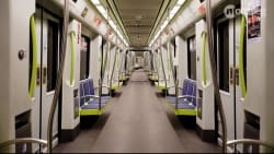
This includes public transport, with the metro (lines 3, 5, 9), the tram (line 10), and EMT buses (more than 10 different day lines and 10 night lines).
If you prefer, you can also park and drive electric scooters all around the station or find the taxi rank just to the side of the building.
On foot
Given that Estación del Norte is in such a privileged position, it is normal that reaching it on foot is not difficult at all.
You’ll find the train station just south of Ciutat Vella, east of the Bullring and west of Chinatown. If you are in the Old Town, going on foot is certainly the easiest option.
Metro and trams
The closest stations are:
- Xàtiva (view map), the metro stop right in front of the station.
- Colón (view map), a metro stop northeast of the station*.*
- Alacant (view map), the tram stop right between the train station and the Bullring.
Xàtiva is only 1 minute away from the Bullring, while Colón is 600 m away (7-minute walk, a little under 0.4 miles) from it. The same three lines (3, 5, 9) stop at both stations.
The tram network’s line 10 stop, Alacant, is to the side of the building.
For detailed information about how this system works, you can read our article about the metro and trams in Valencia.
Buses
The closest bus stop is probably the one called Estació del Nord, opposite the station. To reach it you’ll only need to cross to the other side of the street (1-minute-walk). The other bus stop is called Xàtiva. It is a little down the street, to the west, but still very close (140 m, about 0.2 miles).
You’ll find other stops all around the train station area, but these two are the ones with the most lines - both regular and night lines.
Here are the most important daytime lines.
| Line |
|---|
| Stop |
| Details |
| Line | C1 | 6 | 7 | 8 | 11 | 19 | 28 | 35 | 40 | 70 | 71 | 73 |
|---|---|---|---|---|---|---|---|---|---|---|---|---|
| Stop | Xàtiva | Estació del Nord | Xàtiva | Estació del Nord | Xàtiva | Estació del Nord | Xàtiva | Estació del Nord | Estació del Nord | Xàtiva | Xàtiva | Xàtiva |
| Details | It is a circular line that runs the length of the old city walls, hugging the old quarters of the city. Some of its stops are Puerta de la Mar, Plaza del Ayuntamiento, Xátiva, Torres dels Serrans. | This line crosses the city north to south, making quite a few stops in the western part of the city and along the TuriaPark. | This line connects the south-western part of the Old Town with other southern neighbourhoods of Valencia, like Chinatown, the area surrounding the two train stations, and Russafa. | This is a line that dwells mostly in the southern and western parts of the city centre, around the two train stations and the Ruzafa neighbourhood. | This line crosses Valencia’s urban area from southwest to northeast. On its route, it stops by some important spots, like the Plaza del Ayuntamiento, Estación del Norte, Colón, and the TuriaPark. | It connects the central areas around Plaza del Ayuntamiento and Xátiva to the seaside, stopping by the Cabanyal neighbourhood, and near Les Arenes and Malvarosa beach. | This line runs the entire length of the old city walls, circumscribing the old quarters of the city. It also goes into the neighbourhoods north of the centre for a stretch. | It connects the main train station, the Plaza del Ayuntamiento, and the Eixample with the neighbourhoods that stand between the city and its beaches. | This line connects the southeastern part of the Old Town and theEixample with the Blasco Ibáñez area. | This line connects the western areas of the city with the southern areas of the Old Town, and then proceeds towards the northeast of the city. | This line crosses the city west to east. On its route, it passes by the main train station, Colón, the Turia Park and the Blasco Ibáñez area. | This line dwells mostly in the western part of the city, connecting the Old Town with neighbourhoods like l’Olivereta and Sant Isidre. |
On top of these day lines, all ten EMT night lines depart from Estació del Nord bus stop. The most interesting of them are:
| Line |
|---|
| Details |
| Line | N1 | N2 | N7 | N9 | N10 |
|---|---|---|---|---|---|
| Details | It connects the station and Colón area with El Cabanyal and the beaches (Malvarosa and Les Arenes). | It connects the station and Colón area with the university area. It then proceeds towards neighbourhoods to the north of the centre. | It connects the station with Ruzafa and other neighbourhoods south of the centre. | Initially, it connects the station with Ruzafa. Afterwards, it proceeds towards El Cabanyal and Neptú. | The route goes from the station to Plaza del Ayuntamiento. It later follows theTuriapark for a bit, then turns towards neighbourhoods north of the centre. |
For detailed information about tickets and how to get them, you can read our article about buses in Valencia.

Taxis
There is a taxi rank right next to the station, in Carrer de Bailèn (view map). Otherwise, it is normally quite easy to hail a taxi in the street in Valencia, but other options are also booking through a mobile app or through a phone call.
See detailed information on this in our article about taxis in Valencia.

Bikes
On the official map , you’ll see that there are bike paths just in front of the train station. Remember you can also cycle in pedestrian zones, as long as there is enough room for people to walk. In terms of leaving your bike at the station, there are bike parking spaces on the west side of the station building.
On the same map, you will also see that there are two Valenbisi stations by the train station. One is right in front of it, the other one is a little further down the street, to the east, in front of the Bullring. Many other Valenbisi stations are also not far away.
If you want to know more about cycling in the city, read our article about biking in Valencia.

If you are interested in Valencia’s public bike rental service, we have an article about Valenbisi (with video guides).

Electric scooters
You can park and drive your electric scooter all around the train station, as it is within the designated circulation area for these vehicles.
If you want to know more about this, you can check out our article about electric scooter rentals in Valencia. In the article, you’ll find step-by-step instructions and video guides to help you through the rental process.