Location and how to get there
Location and how to get there
Being a monument of great interest and also being close to the Vatican and Lungotevere, the Castle can be reached by various means of public transportation , by taxi, or by foot.
By metro
The castle doesn’t have its own stop, but the closest ones are both on the A line of the Rome subway network. The stops in question are Lepanto and Ottaviano, consecutive to each other, and both about 1.3 km (about 15 minutes walk) from the entrance of the castle.
A single ticket (BIT) costs € 1.50, but there are also metro tickets for 24h, 48h, 72h hours, or for one week available.
More info on the metro of Rome.
See details on tickets and subscriptions for public transportation in Rome.
By tram
As for the tram, the closest station to the Castle is Ottaviano, on line 19 of the tram network of Rome. Once you arrive at the stop, the Castle will be 1.3 km from you (16 minutes by foot). To get there, just take Via Silla and continue straight towards the Tiber, until you reach Via Stefano Porcari. Continue along this street until you are in front of the Castle’s park. You can walk along it until you are in front of the entrance of the monument.
BIT tickets for €1.50 (for a single journey) can be used for Rome’s tram network, as well as other available public transportation options.
Find more info about the trams in Rome.
See details about tickets and subscriptions for public transportation in Rome.
By bus
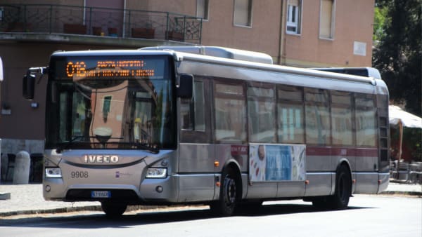
This is the means of transportation that offers the most options, although the speed of the bus service is often diminished by the traffic in the center.
Lines 23, 34, 40, and 62 all stop at Piazza Pia/Castel S. Angelo, while line 280, in addition to this last stop, also has another one near the Castle, that is Lgt Tor di Nona/Rondinella.
| Line |
|---|
| Nearest stop* |
| Itinerary |
| Line | 23 | 34 | 40 | 62 | 280 |
|---|---|---|---|---|---|
| Nearest stop* | Piazza Pia/Castel S. Angelo | Piazza Pia/Castel S. Angelo | Piazza Pia/Castel S. Angelo | Piazza Pia/Castel S. Angelo | Piazza Pia/Castel S. Angelo or Lgt Tor Di Nona/Rondinella |
| Itinerary | It connects Clodio (north of the Vatican) to Pincherle (south of Rome), practically following the course of the Tiber. | It runs a short distance, from beyond Castel Sant’Angelo to the Vatican. | It takes you from Termini Station to Castel Sant’Angelo, passing by Piazza Venezia. | Line that leads from Tiburtina Station almost to the gates of the Vatican, next to Castel Sant’Angelo. | It connects a suburban area, north of Rome, with Ostiense Station, south of Rome, passing near the Vatican and Trastevere. |
City buses use the same fare system as Rome’s metro, subway, and suburban trains. As mentioned above, a one-way ticket (BIT) costs €1.50 and it’s also possible to buy season tickets of different durations.
By taxi
Cabs are obviously the most comfortable option, but they are also the most expensive and are not guaranteed to be the fastest way to get to Castel Sant’Angelo due to the heavy traffic in the central area of Rome.
However, this means of transport is a good option if you feel like chatting with a cab driver, who can tell you a few secrets of the city or entertain you with his typical Roman humor.
The best way to get a cab in Rome is to book it by phone, mobile apps, or simply by going to a cab stand.
By foot
Definitely the most recommended option to enjoy the monumental beauty of the Eternal City to the fullest. It may well form part of a visit to the beautiful Lungotevere, perhaps as a starting point to then go to the Vatican, and continue along the river to end up in the Trastevere area.


